Solar Potential with LiDAR Data
Mapping the solar PV potential of New York City using LiDAR data, automated ArcGIS pipelines, and a web reporting tool.
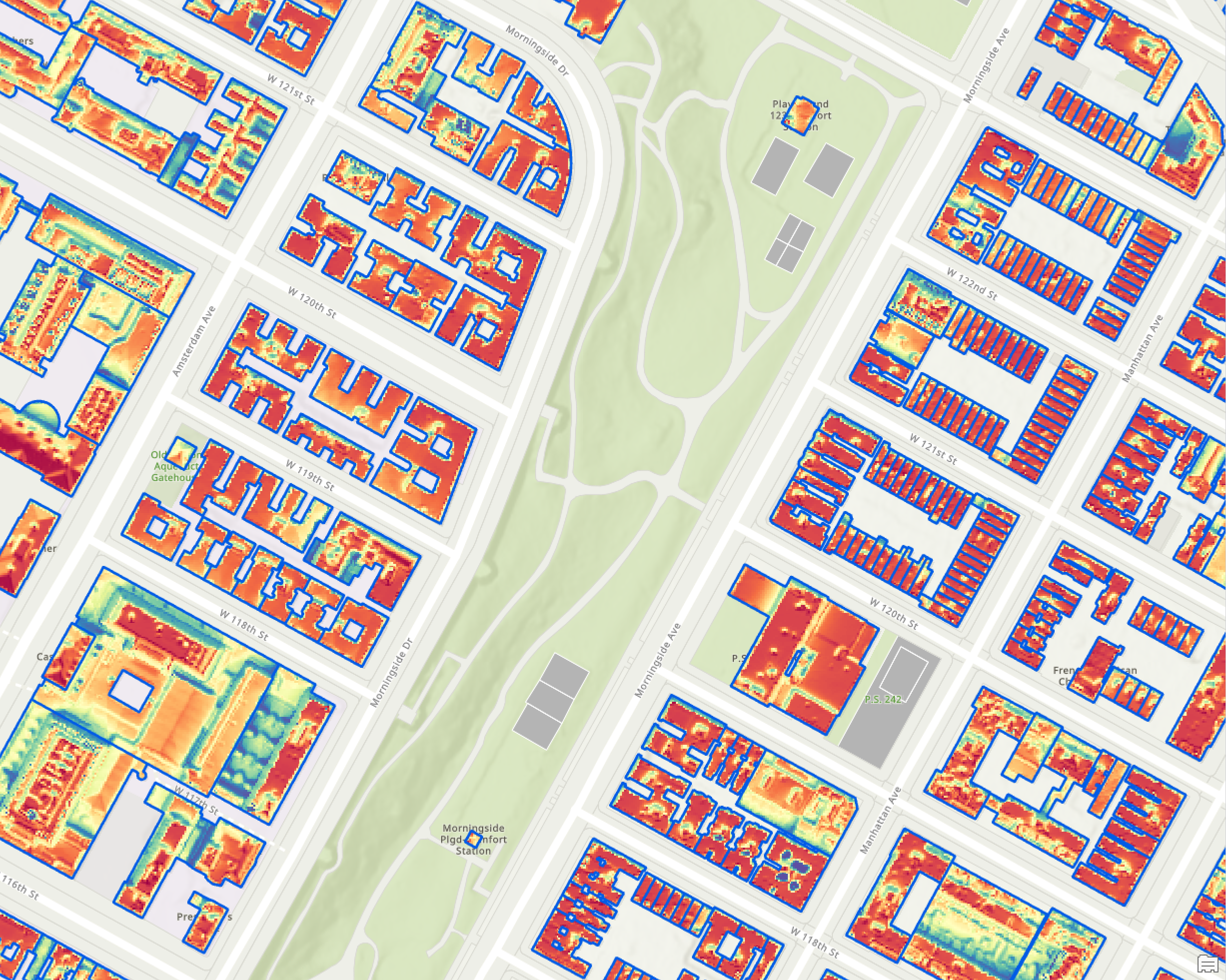
This project aims to map the solar PV potential of New York City using LiDAR data. The project is a collaboration between the Center for Spatial Research and the Center for Design Practice at Columbia GSAPP, funded by the New York State Energy Research and Development Authority (NYSERDA) and the NYC Mayor's Office of Sustainability (MOS).
The project is part of the NYC Solar Partnership — a joint initiative to accelerate solar adoption across New York City. It provides a tool for the City to identify and prioritize solar PV installations on both public and private buildings.
The LiDAR data was used as a high resolution source of elevation information, allowing for more accurate solar analysis. The process was run over 179 tiles of LAS Data from the NYC Open Data repository. Using ArcGIS Model Builder and ArcPy scripting, the workflow was automated to produce a web client-side reporting tool.
The hillshade analysis was used to generate the triangulation model for 3D solar potential analysis, with the PV map clipped and masked to each individual building footprint.
Use cases:
- Local Law 97 — Offset fees and costs for buildings by identifying solar or green roof opportunities
- Designated Affordable Communities (DAC) and Fair Market Trade Zones (FNMTCZ) have additional incentive benefits
